
 |
 |
 |
 |
 |
 |
| Friday 7th August 2009 A day out to visit the old hoverport and the Viking ship at Pegwell Bay |
Friday
7th August 2009 was not very friendly weatherwise. As Iain and I
started our journey by train to Ramsgate station it was very gloomy in
Catford. The train ride, via a couple of changes of train, took nearly
two and a half hours. As we travelled through the Kent countryside
there
were hints that the weather was brightening up, and now and then the
sun did manage to shine. However all the while we were in the Ramsgate
area the weather never really did live up to Accuweather's forecast..........
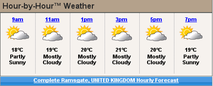

.......or
maybe it did. It depends on exactly what you think the symbols depict.
To me they say the sun is peeping out from behind the clouds, but the
actual weather did correspond to the descriptions. It was mostly
cloudy, and many time it looked like we were in for a shower, but
fortunately for me, travelling without a coat or any other rain
protection, it did stay dry.
Our objective for this day out was to visit the demolished hoverport at Pegwell Bay, and to have a look at the replica Viking ship that is nearby. There is a good write up about the hoverport to be found here. To get to the hoverport meant a walk of nearly 2.5 miles. All my recent days out, and the practice I have had with long walks, I found this walk to be really easy going. Although having Iain along for company helped a lot as well. The furthest we walked from Ramsgate station was actually a tad short of 2.5 miles. (bizarrely, the distance by car is shown as 2.5 miles, and the distance by foor as 2.4 miles. The only difference is that cars have to go round the roundabout outside Ramsgate station clockwise, and by foot we could walk anti-clockwise. )
Our objective for this day out was to visit the demolished hoverport at Pegwell Bay, and to have a look at the replica Viking ship that is nearby. There is a good write up about the hoverport to be found here. To get to the hoverport meant a walk of nearly 2.5 miles. All my recent days out, and the practice I have had with long walks, I found this walk to be really easy going. Although having Iain along for company helped a lot as well. The furthest we walked from Ramsgate station was actually a tad short of 2.5 miles. (bizarrely, the distance by car is shown as 2.5 miles, and the distance by foor as 2.4 miles. The only difference is that cars have to go round the roundabout outside Ramsgate station clockwise, and by foot we could walk anti-clockwise. )
On
the map above (assuming you can see what I can see), "A" is ramsgate
station, and "B" is The Sportsman Pub. The hoverport, and it's
access roads are just to the right of where it says "End", just above
and to the right of "B". If you switch to Satellite view, and
zoom in, the outline of the old hoverport is clearly visible. As well
as the direct route, along the blue line between "A" and "B" we also
wandered around the hoverport, and explored a little bit of the
coastline as far as the cliffs one end, and the marsh the other end
would allow use. Add in walking out to the main road to see the Viking
ship, and then back into the hoverport again, we estimate that we
walked in excess of 6 miles just in the Ramsgate area. Apart from going
up a steep hill on the approaches to Ramsgate station, on our way home,
it all seemed remarkably easy.
Our first view of the hoverport was from the cliffs that are just to the north east of the hoverport.
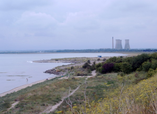
With the (apparently) disused Pulborough power station in the background,
this was our first view of the hoverport.
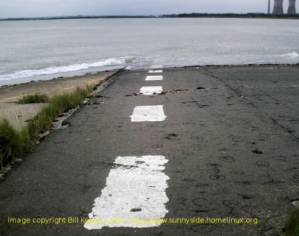
Although all the building have long since been demolished, the markings where the hovercraft were stationed has resisted the sea, and are still very much intact. This was also true for all the marking out for the car parking area which nature is doing her best to reclaim.
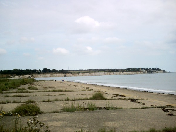
Above is the view taken along the concrete apron that the hovercraft "took off" from as they went out to sea.
I took two differnt cameras with me, and the view below was taken with the other camera.
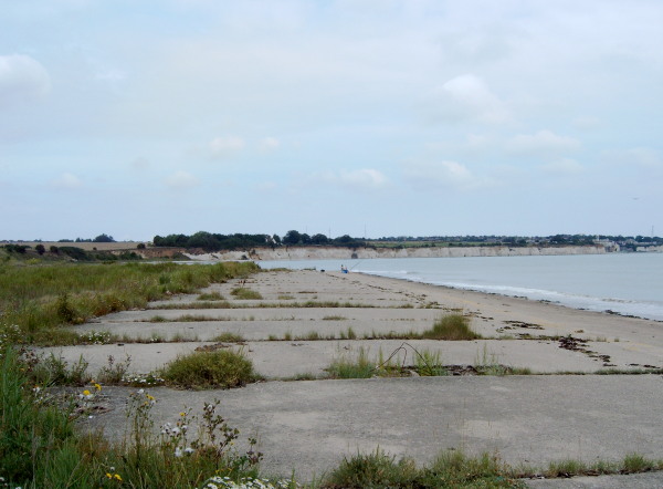
In the very centre of this picture is a dark "blob". It is a shallow cave in the chalk cliff.
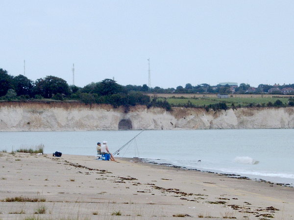
This is a closer view of the cave. I wanted to try and see it close up, but we couldn't get to it for reasons that I will explain soon
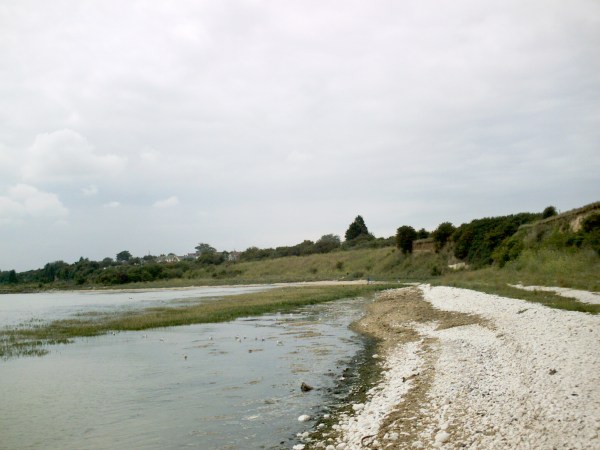
The view above is looking approximately south, or looking back from nearly as close as we could get to the cave entrance.
Stretching out into the sea is what I believe to be called sea grass. At low tide it would be visible as a green carpet covering nearly all of the northern end of the bay.
Our first view of the hoverport was from the cliffs that are just to the north east of the hoverport.

With the (apparently) disused Pulborough power station in the background,
this was our first view of the hoverport.
Before
the hoverport was built, I presumed that Pegwell Bay was probably just
a marshy area surrounded by cliffs. Maybe it was, but there is a
picture of an old oil painting here that suggests slightly otherwise.

Although all the building have long since been demolished, the markings where the hovercraft were stationed has resisted the sea, and are still very much intact. This was also true for all the marking out for the car parking area which nature is doing her best to reclaim.

Above is the view taken along the concrete apron that the hovercraft "took off" from as they went out to sea.
I took two differnt cameras with me, and the view below was taken with the other camera.

In the very centre of this picture is a dark "blob". It is a shallow cave in the chalk cliff.

This is a closer view of the cave. I wanted to try and see it close up, but we couldn't get to it for reasons that I will explain soon

The view above is looking approximately south, or looking back from nearly as close as we could get to the cave entrance.
Stretching out into the sea is what I believe to be called sea grass. At low tide it would be visible as a green carpet covering nearly all of the northern end of the bay.
That sea grass has one unfortunate effect, and one unfortunate
attribute. It tends to trap a lot of detritus in the corner of the bay,
and as it does it leaves behind a lot of decaying matter that is washed
up onto the shore line. The end result is that corner of the bays
stinks, and the water looks disgusting. The decaying vegetation, and
the stink were the main reason I did not attempt to get to the cave
mouth. It would have meant wading through water that was just YUCK, but
probably not that deep to wade through. Later on, as the tide went
down, and the waters retreated, it is probable that I still would not
have wanted to make my way through the big stink.
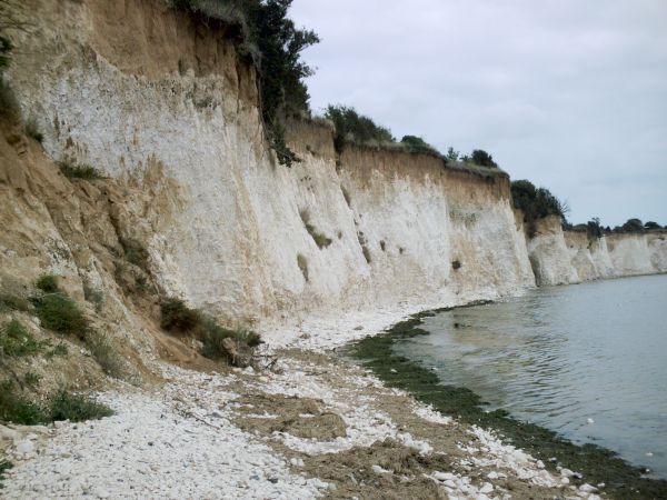
About a third of the way up this picture is as far as we got towards the cave that is tantalisingly just a 100 - 150 ft further on.
The green scum at the water's edge is clearly visible, as is the beige coloured rotting vegetation, and other detritus in the foreground. This point also marks the start of the Thanet chalk beds as can be seen where the cliff turns from brown (to the left) to white (to the right). This change in geology would have been far easier to see if I could have photographed it head on from out to sea.
After
our first wander around the hoverport, and exploring up as far as the
big stink, we headed out back to the main road to take a look at the
Viking ship. There is a bit more information about the Viking
ship on the BBC's website.
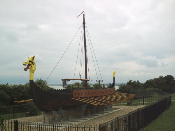
above, the view from the landward side, and below, the view from the seaward side
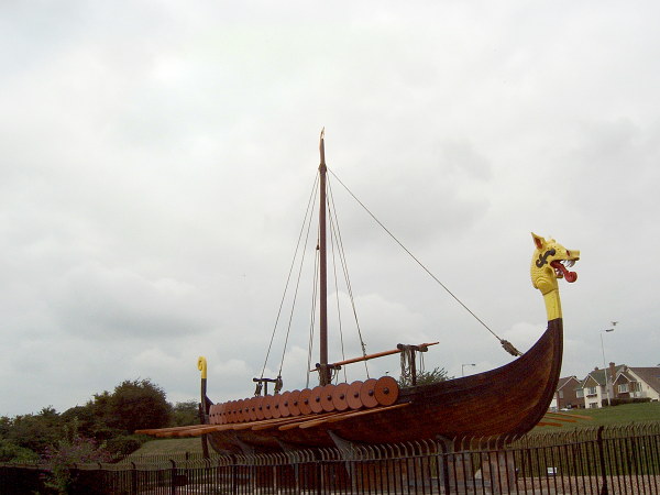

Close up of what is probably supposed to be a serpents head on the front of the Viking ship. To me it looks more Chinese in origin - a dragons head.
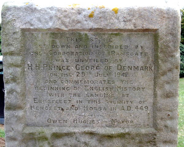
Commemorative stone alongside the Viking ship
(note: I have "photoshopped" in the 49 of 1949 because it was too indistinct on the original photograph)

above, the view from the landward side, and below, the view from the seaward side


Close up of what is probably supposed to be a serpents head on the front of the Viking ship. To me it looks more Chinese in origin - a dragons head.

Commemorative stone alongside the Viking ship
(note: I have "photoshopped" in the 49 of 1949 because it was too indistinct on the original photograph)
After looking at the Viking ship we went back down to the hoverport for
one last look around. We had hoped that there was a path under the
cliffs that would take us south to a pub we had spied some way down the
main road. We found a large fence, probably put up as part of the
hoverports outer perimeter, stopped us going that way. It was probably
just as well because what we could see of our hoped for path from the
road, was that it would have probably gone through more stinking
marshland. So it was back up to the Viking ship, and then down the road
to The Sportsman pub where we had one pint before making our way back
to the station via two more pubs on the way. There was one other thing
that had to be done before we left the hoverport and made our way to
the frist pub, and that was to have a paddle. This time Iain was there,
with his camera, to capture me almost getting my shorts soaking wet !
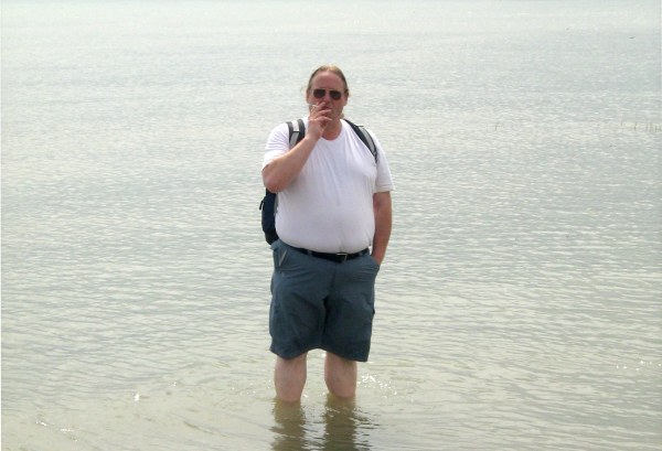
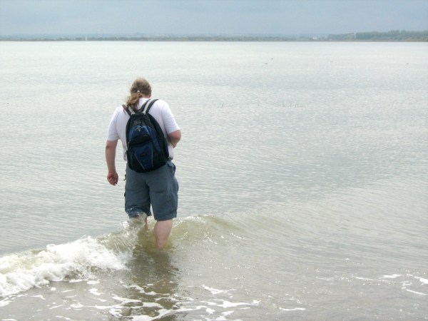


It
was quite possible that giving my feet in a good cooling off in the
water was what made the walk back so easy to do. What is less well
explained is how I survived the whole 2+ hours journey back by train
without suffering extreme nicotine withdrawal symptoms !